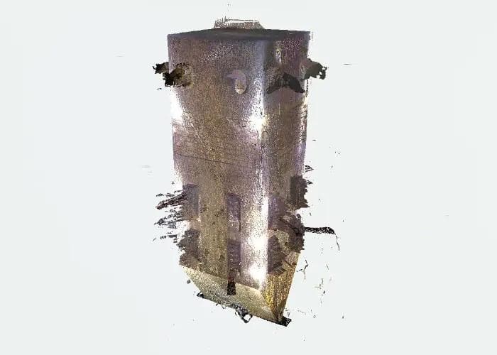
3D Laser Scanning & Data Processing Services
High-Precision Digital Twins, Point Clouds, and 3D Models for Industrial Projects
Why Choose Our 3D Laser Scanning Team?
At our company, we specialize in delivering cutting-edge 3D laser scanning solutions for large industrial projects. Utilizing advanced technology, such as the FARO S70 scanner, we provide precise and detailed 3D data capture tailored to meet your project needs. Our services encompass the entire spectrum of 3D laser scanning, from meticulous planning and data collection to sophisticated data processing, registration, and the creation of point clouds and poly meshes.
Our expertise extends to generating accurate digital twins and AS-BUILT 3D models, essential for detailed analysis and project execution. Our 3D laser scanning services and data processing ensure comprehensive deformation inspections, enabling the detection and documentation of even the slightest structural changes or misalignments. This ensures the highest level of accuracy and reliability in monitoring and maintaining the integrity of your assets.
With our 3D laser scanning services, you gain access to high-fidelity digital replicas, facilitating maintenance, retrofitting, and future planning. Experience the benefits of precise, reliable, and comprehensive 3D data solutions tailored to your industrial project's unique requirements. Contact us to learn how we can elevate your project's accuracy and success.
SCANNING SURVEY SERVICES
At our company, we specialize in providing advanced 3D laser scanning services for large industrial objects using the state-of-the-art FARO S70 scanner. Our service encompasses meticulous planning, thorough preparation, and precise surveying to deliver highly accurate and detailed 3D models tailored to meet your project needs.At our company, we specialize in providing advanced 3D laser scanning services for large industrial objects using the state-of-the-art FARO S70 scanner. Our service encompasses meticulous planning, thorough preparation, and precise surveying to deliver highly accurate and detailed 3D models tailored to meet your project needs.
•Planning more ▼
Effective 3D laser scanning begins with comprehensive planning. Our team works closely with clients to understand project requirements, objectives, and constraints. This includes:
•Site Assessment:Evaluating the industrial site to identify key areas for scanning, potential obstacles, and safety considerations.
•Project Scope Definition:Outlining the specific deliverables, timelines, and milestones to ensure clear communication and alignment with client expectations.
•Resource Allocation:Determining the necessary equipment, personnel, and logistical support required to execute the scanning project efficiently.
•Preparation more ▼
Proper preparation is crucial for successful 3D laser scanning. Our preparation process includes:
•Calibration:Ensuring the FARO S70 scanner is correctly calibrated for optimal accuracy and performance
•Site Setup:Arranging the scanning environment, including the placement of reference markers and control points to facilitate accurate data capture.
•Safety Measures:Implementing safety protocols to protect personnel and equipment during the scanning process.
•Survey more ▼
Our survey phase leverages the capabilities of the FARO S70 scanner to capture detailed 3D data of large industrial objects. This process involves:
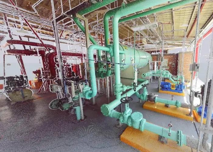
•High-Resolution Scanning:Our Laser scanner captures high-resolution 3D point clouds, providing precise measurements and intricate details of industrial objects.
•Data Acquisition:Collecting comprehensive data from multiple angles and positions to ensure complete coverage and accuracy.
•Real-Time Monitoring:Continuously monitoring the scanning process to address any issues promptly and ensure data integrity.
•Benefitsmore ▼
Our laser scanners offers several advantages for industrial projects, including:
•High Precision:Achieving an accuracy of up to 1mm, ensuring highly detailed and reliable 3D models.
•Speed and Efficiency: Fast scanning speeds allow for the efficient capture of large areas, reducing downtime and project duration.
•Versatility:Capable of scanning various industrial environments, including complex geometries and hard-to-reach areas.
Our 3D laser scanning services, powered by the FARO S70 scanner, provide unparalleled accuracy and detail for large industrial projects. From planning and preparation to precise surveying and data processing, we deliver high-quality 3D models that support informed decision-making and project success. Contact us to learn more about how our services can benefit your next industrial project.

In the posts below, you can find more information about this type of service, as well as examples from customers who have implemented these services in engineering projects.
Is the scanning process harmful to the health of operators?
The scanning process emits no radiation and is completely safe for health. The FARO S70 scanner uses laser technology that is non-invasive and harmless, making it suitable for operation in active work environments without posing any risk to personnel.
What preparations should be made in the area that will be scanned?
Before scanning, it’s essential to ensure that the object meets safety standards for our operators, providing a secure working environment. Adequate lighting can be beneficial for the operators to move around safely, although our FARO S70 scanner collects data accurately even in low light. Additionally, access to a power source for battery recharging is recommended to maintain uninterrupted scanning during the process.
What is the accuracy level of your 3D laser scanning services?
Our 3D laser scanning services, powered by the FARO S70 scanner, achieve a high level of accuracy.Between the actual object and the generated point cloud, the accuracy is ±1mm.
When we develop a 3D model from the point cloud, the accuracy can be tailored to customer specifications, ranging from ±1mm to ±1cm based on project needs. This ensures that our models align precisely with the requirements of each industrial project.
What are the steps involved in your 3D laser scanning process?
Our process includes meticulous planning, careful preparation, and precise surveying using the FARO S70 scanner. After data capture, we process and refine the data to create a high-resolution 3D model tailored to your project needs.
How can I request a 3D scanning survey for my project?
Contact us through our website or via email to discuss your project’s needs. We’ll provide you with a customized quote and a clear plan to conduct an efficient and accurate scanning survey.
What information should I prepare before scheduling a scanning survey?
Please provide details about the project’s scope, specific areas to be scanned, and any site access or safety requirements. This helps us tailor our services to meet your expectations and project needs.
POINT CLOUD REGISTRATION AND POLY-MESH
At IN 3D Technology, we specialize in point cloud registration, a critical process that ensures your spatial data is accurate and cohesive. Point cloud registration involves aligning and merging multiple point clouds to create a single, unified model. This technique is essential for industries ranging from construction and architecture to manufacturing and engineering.
•Point Cloud Data:more ▼
•Enhanced Accuracy:By aligning multiple point clouds, we eliminate discrepancies and ensure a high level of precision in your 3D models.
•Comprehensive Data:Merging different datasets provides a complete and detailed representation of the scanned environment or object.
•Efficiency:Streamlining multiple point clouds into one coherent model saves time and reduces the complexity of data management.
•Our Expertise: more ▼
•State-of-the-Art Technology:We utilize the latest software and algorithms to achieve precise and reliable point cloud registration.
•Experienced Professionals:Our team of experts has extensive experience in handling complex point cloud data, ensuring top-notch results.
•Tailored Solutions:We customize our approach to meet the specific needs of your project, whether it's a large-scale construction site or a detailed mechanical component.
•Applications:more ▼
•Digital Twins:High-fidelity digital replicas of the industrial objects for analysis, simulation, and visualization.
•AS-BUILD 3D Models:Accurate representations of existing conditions, facilitating maintenance, retrofitting, and future planning.
•Technical Documentation:Comprehensive reports, including point cloud data, 3D models, and detailed analysis for client review and decision-making.
At IN 3D Technology, we are committed to providing precise and reliable point cloud registration services that enhance the quality and accuracy of your projects.
Transform Your Point Clouds into Detailed 3D Mesh Models with IN 3D Technology
Poly-mesh creation is the process of converting point cloud data into a polygonal mesh, a crucial step in creating detailed and accurate 3D models. Our expertise in poly-mesh creation ensures that your models are not only precise but also optimized for various applications, from virtual reality simulations to engineering analyses.
•Poly-Mesh Data: more ▼
•Detailed Representation:Capture the intricate details of scanned objects or environments, providing a true-to-life 3D model.
•Versatility: Our poly-mesh models are compatible with various software and platforms, making them ideal for diverse applications.
•Optimization:We focus on creating meshes that balance detail with performance, ensuring smooth operation in your preferred software environment.
•Our Approach: more ▼
•Advanced Tools:We employ cutting-edge tools and techniques to transform raw point cloud data into high-quality polygonal meshes.
•Quality Control: Each poly-mesh undergoes rigorous quality checks to ensure accuracy and completeness.
•Custom Solutions:We tailor our poly-mesh creation process to fit the unique requirements of your project, ensuring optimal results.
•Applications: more ▼
•Virtual Reality & Simulation: Immersive and realistic 3D environments for training, visualization, and interactive experiences.
•Engineering & Design: Accurate models for CAD applications, facilitating design, analysis, and manufacturing processes.
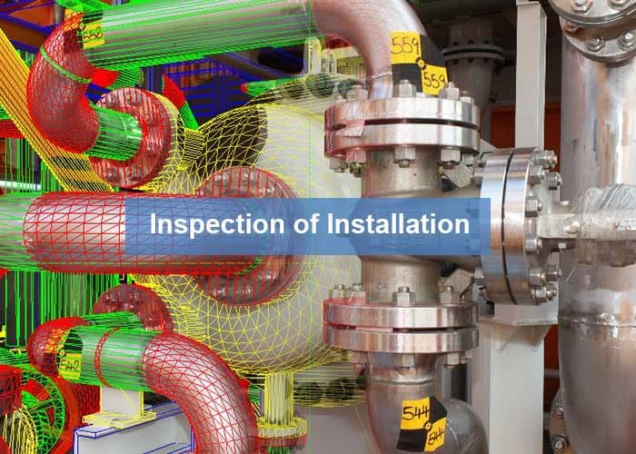
•Deformation Inspection:Poly mesh models allowing for precise analysis of structural changes and misalignments.
At IN3D Technology, we deliver top-tier poly-mesh creation services that bring your point cloud data to life, providing you with detailed and optimized 3D models for any application.

In the posts below, you can find more information about this type of service, as well as examples from customers who have implemented these services in engineering projects.
Which software can we use to import the point cloud?
We provide software that allows you to view the point cloud, but you can also use other programs such as Navisworks, AutoCAD, Recap, and more to work with the point cloud data.
How long does it take to complete the data registration?
The time required for data registration depends on the scanning resolution and the number of scanned positions. For an industrial object that includes up to 250 positions, the process may take 5 working days.
How do I get started with your point cloud registration and poly-mesh services?
To get started, simply contact us to discuss your project requirements. Our team will guide you through the process, from data collection to the final model delivery, ensuring a seamless experience.
What is a poly-mesh, and how is it created from point cloud data?
A poly-mesh is a polygonal representation of a 3D model created from point cloud data. The process involves converting the dense point data into a mesh of polygons.
Can you provide custom poly-mesh models based on specific project requirements?
Yes, we offer customized poly-mesh creation services tailored to meet the specific needs of your project, ensuring that the final model aligns with your operational requirements and specifications.
Can we import the point cloud into SolidWorks?
Unfortunately, there is currently no option to import point clouds directly into SolidWorks.
